 SeaChart
Yes, SeaChart's Android app can display downloaded nautical charts without mobile internet. Download the required overview charts and the detailed blocks for your trip while connected, check your offline licence, then verify the maps on the phone you will take aboard.
How do I download charts in SeaChart?
- Open the app's offline chart settings. Connect to a reliable network and sign in. Current builds separate overview charts from detailed charts; wording may differ in older versions.
- Complete the required overview downloads. These provide the general chart view. A global overview does not mean detailed survey coverage is available everywhere.
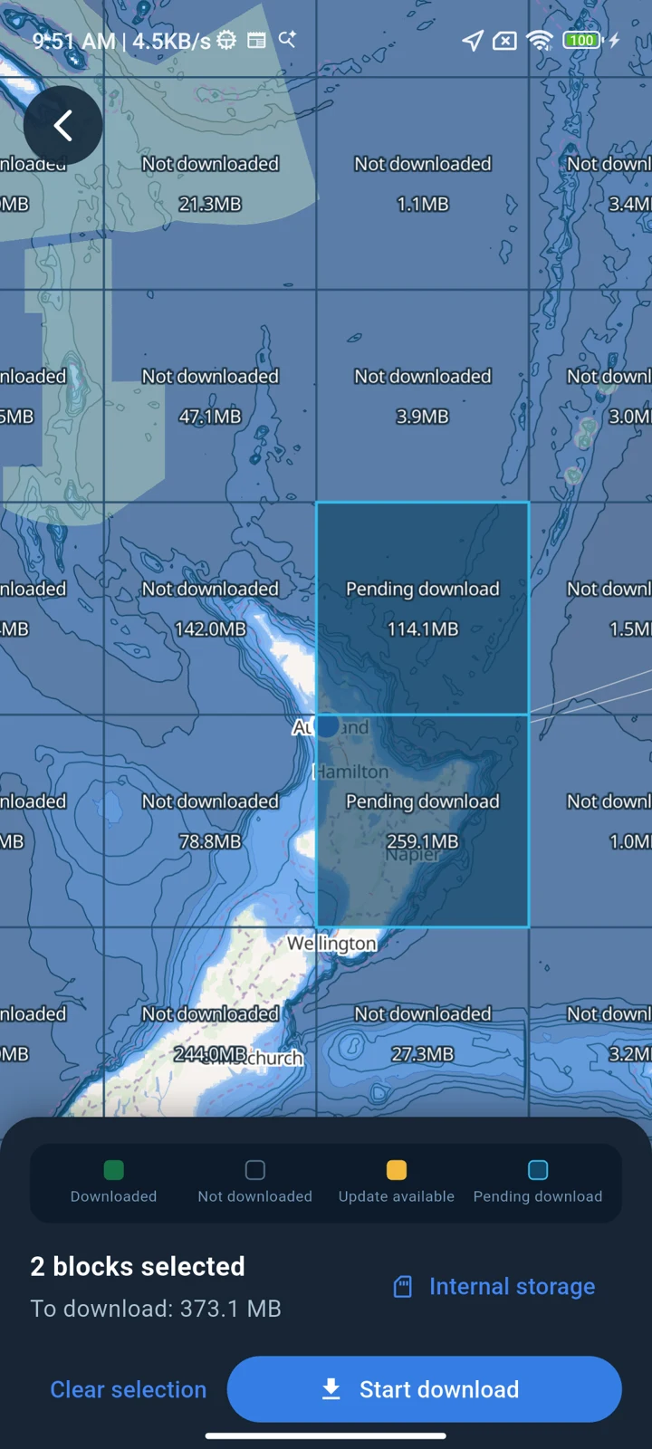
- Select detailed chart blocks on the download map. Include the area you intend to visit and suitable alternatives. Check the available layers and leave room for downloading and installing the files; storage needs depend on your selection.
- Wait for download and verification to finish. A selected block or a progress indicator is not proof that its files are ready. Resolve incomplete or failed downloads before leaving reception.
- Check the account's offline licence. In account settings, check the displayed offline-valid-until time. If it expires before your trip ends, reconnect and sign in to renew it before departure.
How can I check that my charts really work offline?
Turn off mobile data and disconnect from internet-connected Wi-Fi for this check. If using airplane mode, make sure location services remain enabled. Then open SeaChart again.
- Open your destination and pan beyond the last view you used online.
- Try the expected zoom levels, including detailed harbour or coastal areas.
- Check depth and seamark layers separately from the coastline basemap.
- Open the saved routes and marks you need on this device.
- Confirm the offline licence covers the time you will be away.
- Reconnect and resolve any missing files before departure.
For a practical area to inspect, open the Australian marine chart guide or New Zealand marine chart guide.
What works offline, and what still needs a connection?
| Feature | Offline requirements and limits |
|---|---|
| Saved nautical charts | Completed, installed downloads and valid offline access are needed. The selected blocks and source data determine coverage and detail. |
| GPS position and tracks | The device needs location permission and a usable position fix. A downloaded chart does not create GPS reception. See the GPS and track guide. |
| Weather and tides | Download or load the information you need in advance and check its dates and coverage. Refreshing forecasts needs internet; saved information does not update while disconnected. |
| AIS from onboard equipment | A compatible receiver or gateway must remain reachable over the configured local TCP/UDP connection. You may need to re-enable local Wi-Fi after testing offline maps. See the AIS setup guide. |
| Online satellite imagery and account sync | Do not assume that every online layer or cloud feature is included in an offline chart download. Check the actual view and saved content before your trip. |
Do downloaded files work after my offline licence expires?
The files alone do not extend account access. SeaChart displays an offline licence deadline in account settings. When it expires, connect to the internet and sign in to renew it. Do this before leaving reception rather than relying on a connection offshore.
Why is an area blank after downloading?
Check the required overview files, selected detailed blocks, download status, visible layer and offline licence. If the detail is also absent online, downloading the same files again will not create new source coverage. Zooming in further does not create a higher-resolution survey.
If the area appears online but is missing offline, reconnect and check the relevant downloads. If it still fails, send your app version, affected area and layer, plus a screenshot of download status, to [email protected]. See Help & Support for contact details.
