 SeaChart
 brings your position, saved routes and recorded tracks onto a marine map. A useful setup starts with a reliable device location, then a route you understand and a recording workflow you have checked.
Position, route and track are different
- Position
- Your device's current location. Permission alone is not a GPS fix; the phone must supply a usable location.
- Route
- A planned path or imported set of route points. Importing a file does not validate its passage or ensure the chart data covers it.
- Track
- A record of where the device travelled while track recording was active. It describes a past journey, not a safe route for a future one.
Set up on the device you will use
- Allow location access. Enable device location services and grant the app the permission needed for the features you use. Wait for a usable position before interpreting the map.
- Inspect the chart area. Check the available depth and seamark layers and read their limits. Download the area if you need it without reception.
- Open or import your route. SeaChart supports GPX and KML import/export. Check imported points, names and the whole route on the map; a file can contain incomplete or unsuitable information.
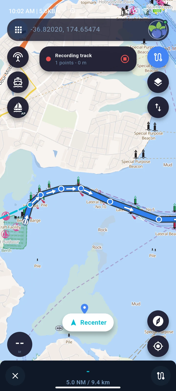
- Start and stop recording deliberately. Use the app's recording controls for a track you want to save. Check the result after a short familiar journey before expecting a complete longer record.
Check the phone when the screen is locked
Navigation, recording and anchor watch can require ongoing location updates. Device permissions, battery restrictions and background behaviour can interrupt them. Check the relevant feature on your own phone, including a screen-off period; do not assume behaviour is identical across Android and iOS.
Keep sufficient battery capacity and access to the controls. Stop the active location feature using its Stop control when you no longer need it.
When the position or track does not look right
- No position: check location services and app permissions, then whether the device has a usable fix.
- Position shown on a blank map: GPS and chart coverage are separate. Check the selected layer and saved downloads.
- A gap in a track: check when recording was active and whether background operation or location reception was interrupted.
- An imported route looks unexpected: inspect its points before use. GPX/KML support does not establish the quality of the original file.
Use the browser for planning context
The online chart gives a quick view of available layers and has a location button when browser permission is granted. App track recording, downloaded charts and onboard AIS setup are separate mobile features.
See offline preparation and AIS receiver setup for those workflows. SeaChart assists preparation and situational awareness; it does not replace official charts, watchkeeping or professional marine navigation equipment.
