Feature request: Import or use third party maps
The ability to import or overlay/underlay third party maps with transparency control.
Satellite maps
Sea Marker maps
etc.
Thank you for your feedback.
We have already identified an issue where the chart or depth map may display incorrectly when the app is using one of the following languages:
Arabic
Thai
Hindi
Burmese
Khmer
If you are currently using one of these languages, you can temporarily switch to another language in Settings. This issue will be fixed in the next version.
Regarding satellite maps, this app is mainly designed around offline use. Providing satellite imagery for offline use would require an extremely large amount of data — potentially hundreds of GB for a single country — which is not very practical. This is also one of the reasons why I did not include satellite maps previously.
I will do some further research into the possibility of integrating satellite imagery as an online map layer. If I cannot find a practical solution that provides a good user experience, I will close this ticket.
Thank you again for the suggestion and feedback.
Thank you for the response
I only meant to use online sat layer for those who need or like it, and only as an added feature as an overlay or underlay
I understand that it requires a huge amount of data to have it offline, that was never my intention
Thank you again
Using 3rd party maps is another matter
I have several freely available nautical maps that contain additional details and I used them as overlay or underlay in Osmand
Might be useful for some users
If there is a way, I can upload them for you to examine
Thank you for providing the SQLite map files.
I reviewed the files and found that they do not actually contain offline map tiles. Instead, they mainly contain configuration information and URLs that instruct the app to connect to external servers and download map tiles online.
The main difficulty with supporting this type of file is licensing and copyright compliance.
If the app allowed users to import arbitrary online tile sources, it could potentially be used to access copyrighted map data through unofficial endpoints, proxies, or other methods that are not permitted by the original map provider.
For example, Google states that Google Maps tiles and satellite imagery must be accessed through the official Google Maps Platform:
https://developers.google.com/maps/faq
Apple’s App Review Guidelines also require apps that access or display content from third-party services to have permission to do so under the relevant service’s terms of use:
https://developer.apple.com/app-store/review/guidelines/#third-party-sites-services
Google Play similarly prohibits apps that infringe intellectual property rights or facilitate infringement:
https://support.google.com/googleplay/android-developer/answer/9888072
For these reasons, I cannot safely support unrestricted importing of this type of online map-source SQLite file in its current form.
However, I may still investigate support for genuine offline map databases, where the actual map tiles are stored inside the file, remain entirely on the user’s device, and the user has the necessary rights to use that data.
Support for specific licensed online map providers may also be considered separately if they provide an official API or other authorized method of access.
Thank you again for sending the files. They were very helpful in understanding exactly how this type of map database works and what functionality you were requesting.
Thank you for the clarification
perhaps a better approach is to have the option for the user to import and convert their own maps from popular formats
This way the issue of copyright or whether the map is free falls on the user
in particular I was thinking of .gpx route/ way points and fishing data which is freely shared on forums
other chart formats will be added bonus
I have I have not burdened you with so many requests
Thank you again
Thank you again for your suggestion.
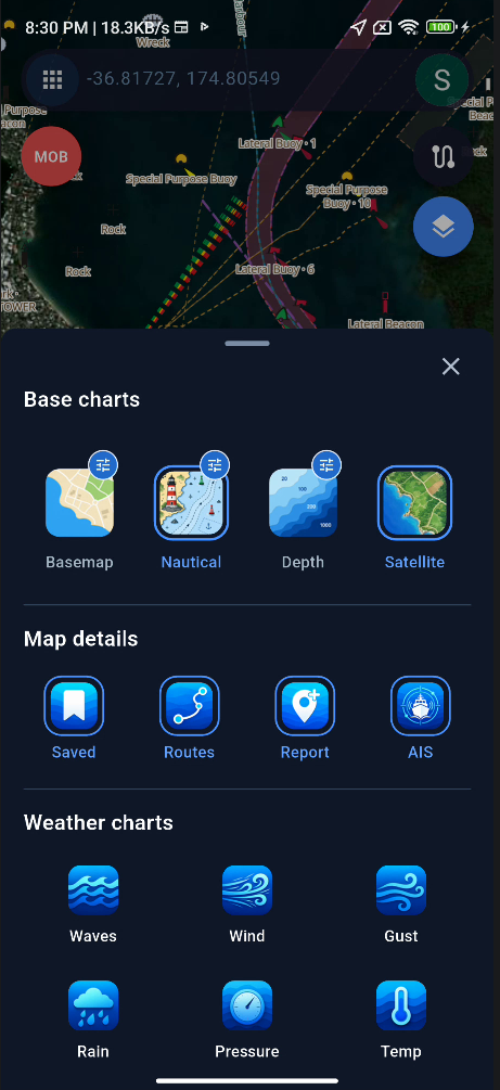
I have now added support for an online satellite map layer, and it is planned to be included in version 2.2.8.
Please note that the satellite imagery currently available has somewhat limited resolution, so it may not appear as sharp or detailed as commercial satellite services such as Google Maps. However, it should still be useful as an optional background layer together with the nautical chart.
I may continue to improve the satellite map source and image quality in future versions if better suitable data sources become available.
Thank you again for your feedback and for helping improve the app.

 SEA CHART /Community