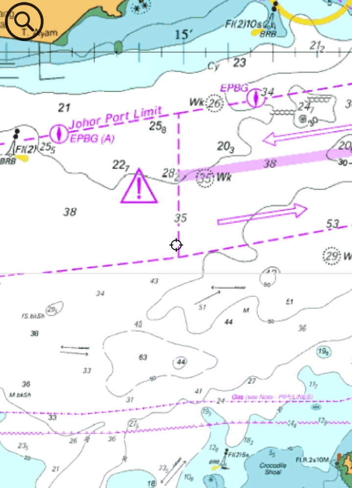
Released p pine2026-07-04 00:50 UTC Please adding a coordinate search feature. I suggest adding a coordinate search feature. + ↳ Reply 1 1 views
Released p pine2026-06-26 23:50 UTC Click the feedback image to enlarge it Tap the image in feedback to view it larger. + ↳ Reply 1 2 views
Released p pine2026-06-25 08:42 UTC Add “Report Missing Facility” Feature to Map Long-Press Menu Please add a new option to the map long-press menu called “Report Missing Facility”. When users long-press on the map, they should be able to report a missing facility at the selected location. The reported data should be submitted to the server and stored as a pending community report. Other users should be able to review and approve the reported facility. Once the report receives more than 5 approvals, the system should treat the facility as verified and consider it as actually existing. Requirements: Add “Report Missing Facility” to the map long-press menu. Use the long-pressed map coordinate as the facility location. Allow the user to select or enter the facility type/name. Submit the report to the server. Store the report as pending until it receives enough approvals. Allow other users to approve the reported facility. If approval count is greater than 5, mark the facility as verified. Verified facilities can then be displayed or used as trusted map data. + ↳ Reply 1 1 views
Normal Question p pine2026-07-03 01:47 UTC ا (Why is there no Mediterranean Sea) لي ماذا لا يوجد بحر متوسط + ↳ Reply 1 6 views
Released p pine2026-06-17 14:15 UTC why do not have create route and ais target not showing please update create route option and ais target showing option and update more clear navigation buoy and light and tss route inn and out route path + ↳ Reply 4 18 views
Closed A Arumugam rajesu rajesu2026-06-26 12:05 UTC sir please update nautical map like this I given sample screenshot hi sir please update each navigation details clearly please it is very usefull for navigation it is my humble request please do as much as possible and also update ais target showing around me any vessel or boat must be showing + ↳ Reply 2 16 views
Released p pine2026-06-26 04:00 UTC Map zoom becomes laggy when Weather layer is enabled When the Weather layer is enabled on my phone, the map becomes laggy during zoom in and zoom out. + ↳ Reply 2 3 views
Released p pine2026-06-26 05:30 UTC route downloaded bug When a local route is deleted and then synced with the cloud, the route stored in the cloud will be downloaded again. + ↳ Reply 2 2 views
Released A Arumugam rajesu rajesu2026-06-26 02:11 UTC thank you for your new route update sir thank you and please also update manually input route create and editing by co-ordinate point like latitude and longitude manually editing and input for create route and also input some text display reminder also like pilot call channel like call to master reminder on chart also ais target display please update + ↳ Reply 4 8 views
Released p pine2026-06-23 05:51 UTC Add MOB / Man Overboard Function Add a MOB / Man Overboard function to the navigation map. When the user taps the MOB button, the app should immediately save the current GPS location as a MOB point and highlight it clearly on the map. The app should show: The MOB location on the map Distance from the current boat position to the MOB point Direction/bearing to the MOB point A clear visual marker for the MOB point Optional sound alert while MOB mode is active Option to cancel or clear the MOB point This feature is important for marine safety and helps users quickly mark and navigate back to a man-overboard location in an emergency. + ↳ Reply 1 3 views
Released p pine2026-06-24 07:52 UTC Add mph unit on speed meter Add mph unit on speed meter + ↳ Reply 2 7 views
Released p pine2026-06-23 01:47 UTC Wave no current data Wave, wind field, and similar layers cannot show the current data. They only show forecasts starting from 3 hours later. + ↳ Reply 2 1 views
Released p pine2026-06-22 03:10 UTC Add Sunrise and Sunset Time Information Please add sunrise and sunset time information to the app. + ↳ Reply 2 1 views
Released p pine2026-06-22 05:24 UTC Add GPS Status Page Might need following infos: Current latitude and longitude GPS accuracy Current speed Current course/heading Last updated time GPS signal/status + ↳ Reply 2 3 views
Released p pine2026-06-20 09:52 UTC Improve the Save Coordinate UI After Long-Pressing on the Map After long-pressing on a coordinate on the map, the current “Save Coordinate” button is displayed as a balloon icon, which is not clear enough for users. The coordinate information window should always remain visible after a long press. There is no need to add a separate hide button. The save coordinate action should be made clearer, for example by using a more obvious button label or icon, so users can easily understand how to save the selected coordinate. + ↳ Reply 1 4 views
Released p pine2026-06-20 09:08 UTC Add Routes, Waypoints, GPX/KML Import/Export, and Future Cloud Sync Foundation Add a new route-management feature area for SeaChart. The feature should support local route recording, planned routes, waypoint management, GPX/KML import/export, and prepare the data model for future server upload/download sync. Scope: Add a Routes entry button on the top-left of the map screen. Create a dedicated Routes screen/page. Support recording actual GPS tracks. Support managing saved routes/tracks. Support waypoint management. Support GPX import/export. Prepare KML import/export support. Prepare route/waypoint data for future cloud upload/download. Core Concepts: TrackRecord: an actual recorded GPS track. PlannedRoute: a user-created or imported planned route. Waypoint: an independent saved point that can also be referenced by routes. MVP Requirements: User can start, pause, resume, and stop route recording. Recorded tracks are saved locally. User can view saved tracks in a list. User can show/hide saved tracks on the map. User can rename and delete saved tracks. User can create, edit, and delete waypoints. User can import GPX files containing tracks, routes, and waypoints. User can export selected tracks/routes/waypoints as GPX. KML support can be added after GPX if needed. Future Cloud Sync Preparation: All route and waypoint entities should include fields for future server sync: localId serverId name description createdAt updatedAt deletedAt syncStatus lastSyncedAt version isPublic source Suggested sync statuses: LOCAL_ONLY PENDING_UPLOAD SYNCED PENDING_UPDATE PENDING_DELETE CONFLICT Architecture Notes: Keep the feature offline-first. Store all route and waypoint data locally first. Imported GPX/KML data should become local route/waypoint records. Server upload/download should be added later through repository methods without requiring a database redesign. Cloud sync UI can be hidden initially. Auto Route Notes: Auto Route should not be implemented as full automatic safe navigation in the first version. For the first phase, it should be treated as assisted route planning: User selects start/end/intermediate points. App generates editable route segments. App shows distance and estimated travel time. App clearly warns that the route must be manually checked against depth, hazards, restricted areas, and local navigation rules. Acceptance Criteria: Routes button appears on the top-left of the map screen. Routes screen is reachable from the map. Track recording works offline. Saved tracks persist locally. Waypoints persist locally. GPX import/export works for basic tracks and waypoints. Data model includes future cloud-sync fields. Existing navigation mode and Auto Follow behavior are not broken. + ↳ Reply 1 6 views
Released p pine2026-06-20 08:23 UTC Add Donation Support Feature Due to ongoing development costs and server expenses, we urgently need some support from users to help keep the app running and improving. Please add a donation feature inside the app, so users who like the app and want to support its development can make a voluntary donation. The donation feature should clearly explain that donations are optional and will be used to support app development, server costs, maintenance, and future improvements. Expected behaviour: Add a donation entry/button inside the app. Explain clearly why support is needed. Make it clear that donations are voluntary. + ↳ Reply 1 3 views
Released p pine2026-06-25 07:53 UTC Distance measure tool draws line the "wrong way" around the globe near the antimeridian When using the Distance Measurement tool, the connecting line between two points sometimes takes the long way around the Earth instead of the short, direct path. Instead of drawing a short segment between the two tapped points, it renders a line that sweeps across the far side of the globe (e.g. a near-vertical line spanning from the far north to the far south of the visible map), producing a wildly inflated distance reading. + ↳ Reply 2 1 views
Released p pine2026-06-20 22:34 UTC Google Login does not working After my login it shows cancelled + ↳ Reply 2 1 views

 SEA CHART /Community